- Wayfinding aligns spatial planning with human movement
- Visual cues and layout reduce reliance on excessive signage
- Clear navigation improves usability and long-term performance
- System-based planning reduces confusion in high-density environments
- Integration with environmental graphic design strengthens clarity
Movement through a building is rarely accidental. In large-scale developments across Metro Manila and emerging urban centers, how people navigate space is shaped by a combination of layout, visual cues, and behavioral patterns. Within this context, wayfinding in Philippine architecture is not limited to signage. It is a coordinated system that aligns spatial planning with human movement.
As developments become denser and more complex, navigation becomes a critical component of usability. Without clear wayfinding strategies, even well-designed spaces can feel disorganized and difficult to use.
Movement as a Design Framework
Wayfinding begins with planning. Circulation paths, entry points, and transitions between spaces establish the foundation for how users move. Signage supports this system, but it does not replace it.
In mixed-use developments across major business districts and emerging urban centers, the most effective environments are those where movement feels intuitive. Users understand where to go without relying heavily on directional signs. This clarity comes from aligned corridors, visible destinations, and logical spatial sequencing.
Architectural planning and wayfinding must work together. When they are disconnected, signage becomes excessive and often ineffective. In Philippine projects, this misalignment is often seen in retrofitted systems where signs are added after circulation has already been established, resulting in visual clutter rather than clarity.
At a planning level, this also affects how users form mental maps of a space. When routes are consistent and predictable, navigation becomes instinctive rather than learned. This reduces dependence on constant visual instruction and strengthens the overall legibility of the development.
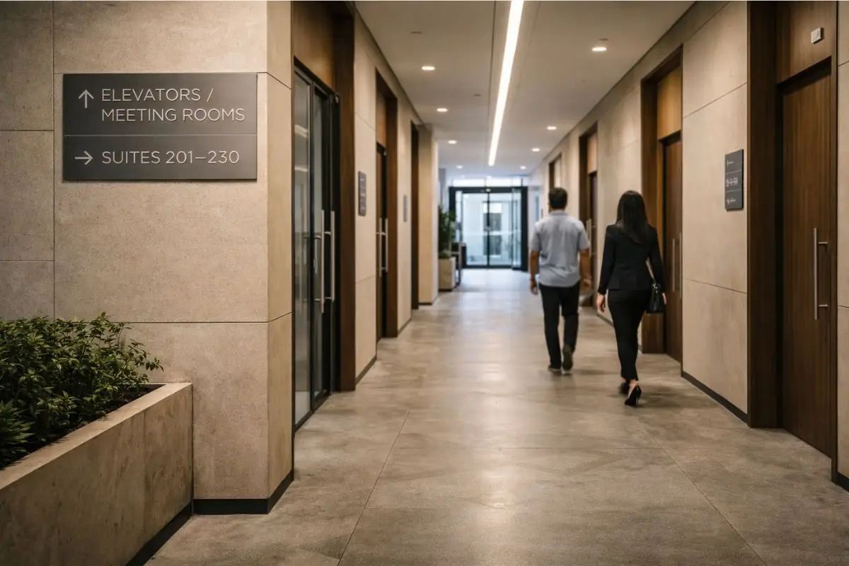
Visual Cues Beyond Signage
Wayfinding is reinforced through materials, lighting, and spatial hierarchy. Floor patterns, ceiling heights, and lighting intensity can signal transitions between public and private zones.
In high-end developments, these cues are often subtle. A shift in material or a change in lighting can guide users without interrupting the architectural experience. This approach maintains clarity while preserving a refined environment.
In contrast, environments that rely solely on signage often feel cluttered and reactive. In the Philippine context, where developments must serve both regular users and first-time visitors, these passive cues become essential in reducing reliance on excessive instruction.
When coordinated properly, these elements create continuity across spaces. Users are able to anticipate where they are going next based on spatial signals alone, reinforcing both usability and overall design coherence.
Reducing Friction in Everyday Use
Effective wayfinding reduces hesitation. In residential buildings, it allows residents and guests to move confidently between lobbies, amenities, and parking areas. In commercial developments, it supports efficient movement between retail, office, and public zones.
This is particularly important in Philippine developments where user behavior can vary widely. Clear systems help accommodate both first-time visitors and regular users, reducing the need for repeated orientation.
Reducing friction improves overall experience and contributes to long-term building performance. When movement is intuitive, operations become smoother, and spaces are used as intended rather than avoided or misunderstood.
At a larger scale, this also impacts how developments manage peak usage. Clear navigation reduces bottlenecks, improves circulation flow, and supports more efficient use of shared spaces over time.
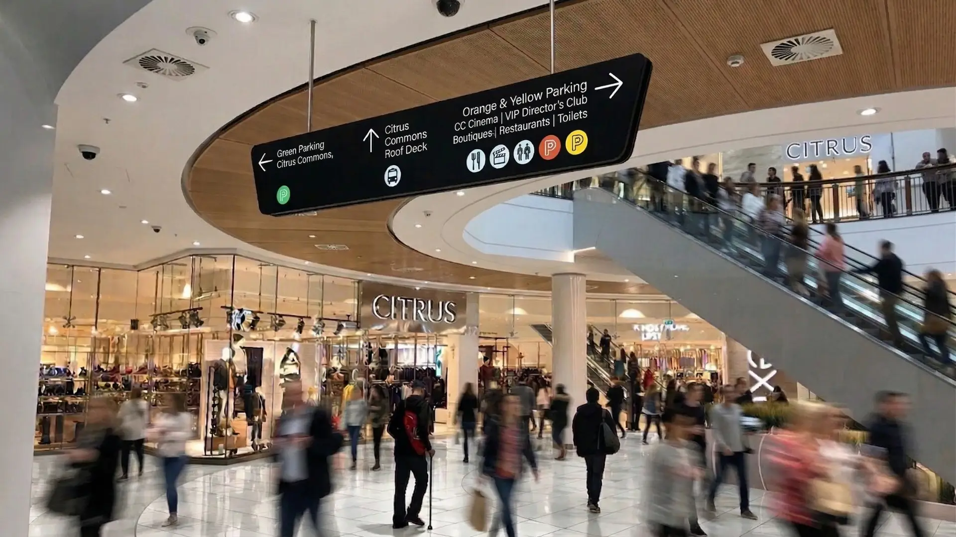
Wayfinding in High-Density Environments
Urban density introduces additional challenges. Multiple entry points, layered circulation systems, and high user volume require coordinated strategies.
In developments across Metro Manila, poorly planned wayfinding often results in congestion and confusion. Elevator lobbies, parking areas, and transition zones become points of friction when navigation is unclear.
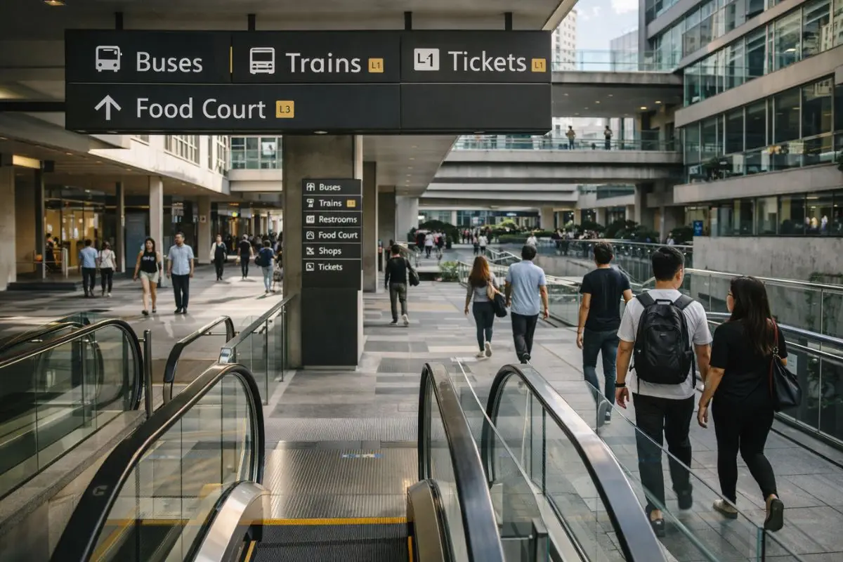
A system-based approach ensures consistency across all levels of the development. From entry markers to directional signage, each element contributes to a unified experience. In wayfinding in Philippine architecture, this consistency becomes critical in maintaining clarity across complex vertical and horizontal movement systems.
Integration with Environmental Graphic Design
Wayfinding operates within a broader communication layer that connects architecture to user understanding. Environmental graphic design provides the visual language, but its effectiveness depends on how early it is aligned with spatial planning.
In practice, this requires coordination between architects and EGD specialists from the outset. Placement logic, sightlines, and decision points must be identified during planning, not after construction. When EGD is introduced late, systems tend to compensate for gaps in circulation rather than support it.
In Philippine projects, where developments often scale quickly, early integration reduces the need for corrective signage and prevents visual clutter. It ensures that information is delivered where it is needed, not where it can still fit.
Embedding Communication Within Architecture
When wayfinding and environmental graphics are embedded within the architecture, communication becomes part of the spatial experience rather than an added layer. Materials, proportions, and alignments reinforce legibility without relying on excessive signage.
This approach supports long-term usability. Systems remain clear even as developments expand or adapt to new uses. Maintenance is simplified, and visual consistency is preserved across phases.
At this level of integration, developments function as coherent systems. Movement, identity, and communication are aligned, supporting both user experience and long-term development performance.
In this context, wayfinding and signage systems in the Philippines are not an added layer but part of architectural thinking, shaping how people move, interpret space, and interact with the built environment over time. Fulgar Architects approaches wayfinding as part of architectural planning, aligning circulation, spatial hierarchy, and user movement within a cohesive development strategy.
Wayfinding structures movement by aligning spatial planning, circulation, and visual cues so users can navigate intuitively.
Signage supports navigation, but without proper spatial planning, it becomes excessive and less effective.
Clear wayfinding reduces confusion, improves confidence in movement, and enhances overall usability of a space.
High density, varied user behavior, and complex circulation systems require adaptable yet consistent navigation strategies.
To explore how wayfinding can be effectively integrated into your development from the outset, get in touch with Fulgar Architects.