













- The 15-minute city proposes communities where many of the places and services people rely on in daily life are within convenient reach of home.
- In the Philippines, proximity-based planning needs to account for walking and cycling alongside jeepneys, tricycles, buses, rail, and the connections between these modes.
- Quezon City has already explored how 15-minute city principles could be applied at the barangay level.
- Developments such as Bonifacio Global City and New Clark City demonstrate aspects of mixed-use, connected, and pedestrian-oriented planning without necessarily following the model literally.
- For Philippine architects and developers, the more useful principle may be creating practical accessibility rather than treating 15 minutes as a strict measurement.
What Does the 15-Minute City Actually Mean?
The 15-minute city proposes a straightforward idea: many of the places and services people rely on in daily life should be within convenient reach of home, including food, education, healthcare, work, recreation, and public spaces.
Popularized through the work of urbanist Carlos Moreno, the concept places proximity at the center of urban planning rather than requiring residents to make repeated long-distance journeys across a city.
Behind the memorable number are several familiar principles of good urban planning:
- Mixed land uses bring homes, workplaces, shops, schools, and services closer together.
- Appropriate density can support neighborhood businesses, services, and public transportation.
- Connected streets and pedestrian routes make shorter journeys more direct.
- Accessible parks and community facilities provide everyday destinations within neighborhoods.
- Multiple transportation options allow people to complete local trips without relying entirely on private vehicles.
The 15-minute measurement therefore provides a useful framework rather than a complete planning formula. For discussions around a 15-minute city Philippines model, the more important question may be how much time, distance, and difficulty residents encounter while going about everyday life.
What Proximity Means in a Philippine City
Applying the concept locally introduces a different transportation environment from the walking- and cycling-oriented examples commonly associated with the 15-minute city.
Everyday mobility in Philippine cities frequently involves several modes within the same journey. A localized interpretation of proximity can therefore consider how these systems work together:
- Walking and cycling can serve short neighborhood trips.
- Tricycles and local jeepney routes can connect residential areas with commercial streets and larger transport corridors.
- Buses, modern jeepneys, and UV Express services can connect districts, business centers, and employment areas.
- Rail systems can accommodate longer journeys across larger metropolitan areas.
- Well-designed transfer points can reduce the difficulty of moving between different modes.
Quezon City provides one of the clearest local examples. The city has explored the 15-minute city approach at the barangay level, considering access to healthcare, employment, parks, education, food, and other essential services. Its broader transport planning also covers jeepney, UV Express, bus, and tricycle routes while identifying areas underserved by public transportation.
A Philippine interpretation may therefore be better understood as a network of convenient short connections rather than a rigid walking radius. Someone might walk to nearby shops, take a tricycle from a residential street to a transport corridor, or transfer from a jeepney or bus to rail for a longer journey.
Good urban design can reduce the distance and friction between each part of that trip.
Mixed-Use Development Is Only Part of the Answer
Philippine developments already demonstrate some principles associated with proximity-based planning, even when they were not conceived specifically as 15-minute cities.
Bonifacio Global City combines residential, office, retail, institutional, recreational, and public uses within a relatively compact mixed-use district. Its planning also incorporates pedestrian environments and a bicycle network, providing alternatives for shorter trips within the district.
Older business districts can demonstrate similar principles through a different urban pattern. Salcedo Village and Legazpi Village in Makati combine offices, condominiums, restaurants, shops, parks, schools, services, and other everyday destinations within relatively compact neighborhoods. Their smaller blocks, interconnected streets, active ground floors, and proximity to major employment centers allow many daily activities to take place within walking distance, even though the districts were not designed around the contemporary 15-minute city concept.
At a larger scale, New Clark City is being planned around housing, commercial activity, parks, community spaces, and future public transportation connections. Plans for its downtown housing development include connections to proposed bus rapid transit and railway systems, demonstrating how neighborhood accessibility and regional transportation can be considered together.
Rockwell Center in Makati offers another variation. Residential towers, offices, retail, schools, recreation, and landscaped pedestrian spaces are concentrated within a compact mixed-use environment. Its more controlled estate setting differs considerably from the surrounding city, but it demonstrates how development planning can intentionally shorten the distances between home, work, services, and leisure.
These places should not necessarily be considered complete Philippine versions of the 15-minute city. Instead, they demonstrate different ways that proximity, mixed land use, pedestrian connections, and access to transportation can shape everyday urban life.
Bringing different uses together can reduce unnecessary travel, but mixed use on a master plan does not automatically produce accessibility on the ground.. Buildings, streets, open spaces, transport systems, and pedestrian routes still have to work together.
This distinction becomes especially important as larger Philippine townships and mixed-use estates are developed in phases. A master plan may eventually contain residences, offices, retail, schools, parks, and community facilities, while early residents still depend heavily on vehicles because many of those destinations have not yet been completed.
For developers, proximity is therefore partly a question of phasing as well as land use.
When 15 Minutes on a Plan Is Not 15 Minutes in Real Life
Physical distance and practical accessibility are not always the same thing.
A condominium may sit only a few hundred meters from an office, mall, school, park, or transport station. On a master plan, the relationship can appear highly walkable. The actual journey may tell a different story.
A short trip can become difficult because of:
- wide roads without convenient pedestrian crossings
- gated developments with limited pedestrian entrances
- disconnected or obstructed sidewalks
- blank perimeter walls that force long detours
- vehicle entrances that repeatedly interrupt pedestrian routes
- bridges or intersections designed primarily around vehicle movement
- poor connections between developments built beside one another
This is where architecture and master planning have a significant role.
Block dimensions, building entrances, ground-floor uses, street connections, pedestrian passages, transport stops, and the relationship between private developments and surrounding streets can determine whether nearby destinations are genuinely accessible.
The useful measure is therefore not simply how close two places appear on a map, but how easily people can actually move between them.
Designing for Climate and Everyday Movement
Distance is only one measure of accessibility in the Philippines. Heat, heavy rainfall, flooding, traffic, and limited pedestrian infrastructure can determine whether a short journey is comfortable or practical.
This makes architectural and landscape decisions part of the mobility discussion.
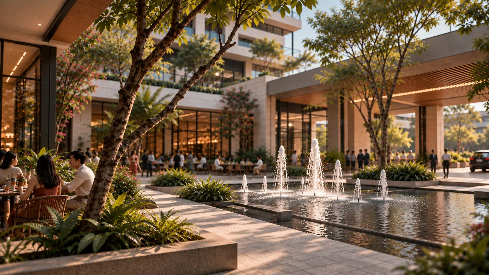
Covered walkways, arcades, trees, shaded waiting areas, drainage, safe crossings, active ground floors, and continuous sidewalks can transform the experience of moving through a neighborhood. In tropical cities, protection from sun and rain is not simply an aesthetic amenity. It can influence whether people choose to walk at all.
The same principle applies to public transportation. A tricycle terminal, jeepney stop, bus station, or rail connection becomes considerably more useful when residents can reach it safely and comfortably.
For architects and developers, proximity-based planning can therefore influence decisions such as:
- the relationship between residential clusters and everyday retail
- placement of schools, clinics, parks, and community facilities
- block sizes and pedestrian connections
- building entrances and their relationship with sidewalks
- locations of transport stops and transfer points
- shaded pedestrian routes and weather protection
- parking and vehicle access that minimize disruption to pedestrian movement
- development phasing that provides useful destinations as communities grow
For a 15-minute city Philippines approach, these relatively ordinary design decisions may ultimately matter more than drawing a perfect radius around a development.
Adapting the 15-Minute Rule to Philippine Development
The strongest lesson from the 15-minute city may not be that every Philippine neighborhood needs to satisfy a literal stopwatch test.
Cities and communities differ in density, transportation, economic activity, land use, climate, and existing infrastructure. A universal 15-minute radius is unlikely to respond equally well to Metro Manila, Cebu, Iloilo, Davao, emerging regional cities, and newly planned townships.
What architects, planners, and developers can borrow is the principle of reducing unnecessary distance and making everyday connections easier.
New communities can consider access to daily services from the beginning. Existing districts can strengthen pedestrian networks, fill gaps in local services, improve connections to public transportation, and create more comfortable public environments.
This approach also allows Philippine developments to respond to existing mobility habits rather than attempting to replace them with an imported model. Walking, cycling, tricycles, jeepneys, buses, and rail can operate at different scales within the same connected urban environment.
The future of the 15-minute city Philippines concept may therefore be less about making every journey exactly 15 minutes and more about designing communities where everyday destinations are closer, connections are easier, and residents have more practical choices for getting around.
It is a proximity-based urban planning concept where many everyday destinations and services can be reached through short trips from home, particularly by walking or cycling.
There is growing exploration rather than widespread adoption. Quezon City has specifically studied how the concept could be applied at the barangay level.
Yes. A localized interpretation can consider walking alongside tricycles, jeepneys, buses, rail, cycling, and convenient transfers between different modes rather than expecting every journey to happen entirely on foot.
No. Different uses can be physically close while poor sidewalks, difficult road crossings, vehicle-oriented planning, disconnected developments, or weak public transportation connections still make them inconvenient to reach.
Developers can consider how land use, pedestrian connections, transport access, climate-responsive design, and project phasing work together to make everyday destinations genuinely accessible.
Fulgar Architects works with developers and institutions to shape master-planned communities, mixed-use environments, and urban developments through architecture and planning strategies that respond to connectivity, accessibility, landscape, mobility, and long-term development goals.