- Township developments require clear navigation systems to support movement across complex environments
- Wayfinding in township developments improves orientation for residents, visitors, and commercial users
- Environmental graphic design supports circulation clarity and operational efficiency
- Integrated navigation systems reduce confusion within large-scale developments
- Adaptable wayfinding systems contribute to long-term development usability
Navigating Complexity in Large-Scale Developments
Large-scale township developments present unique navigation challenges. Residential clusters, commercial districts, shared amenities, and interconnected circulation networks create environments that must remain easy to understand despite their scale and complexity.
In wayfinding in township developments, the goal is to support intuitive movement across diverse spaces used by residents, visitors, tenants, and service personnel. Clear navigation systems are not simply visual additions. They are part of the planning strategy that allows large-scale developments to function efficiently on a daily basis.
Environmental graphic design plays a critical role in maintaining this clarity across complex environments.
Wayfinding as Part of Spatial Planning
Wayfinding is most effective when it is integrated into the architectural layout rather than applied as an afterthought. Circulation paths, entrances, vertical access points, and destination zones must be planned in coordination with signage and visual cues.
In wayfinding in township developments, spatial hierarchy plays a critical role. Primary routes should guide users toward major destinations such as commercial centers, residential towers, and shared amenities, while secondary circulation paths provide access to more localized areas.

When planning and graphics are aligned, users can move through the development with minimal reliance on written instructions. This reduces confusion and improves the overall experience of navigating large-scale environments.
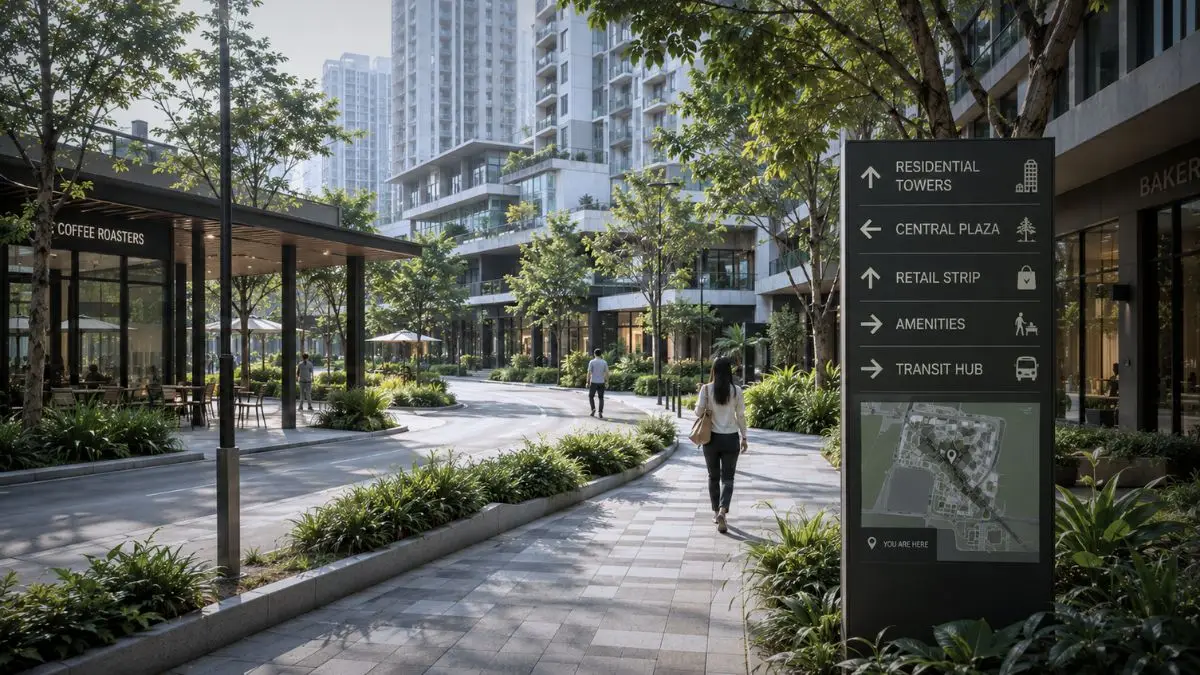
Visual Communication and Signage Systems
Signage is one of the most visible components of environmental graphic design. Its effectiveness depends on consistency and clarity rather than quantity.
Typography, color coding, and iconography must function as a unified system. In township developments, users often move between multiple zones with different functions and varying levels of familiarity. Information must remain legible and easy to understand throughout the environment.
In wayfinding in township developments, clear visual communication supports both navigation and user confidence. Effective signage reduces hesitation and allows movement to feel more intuitive across complex developments.
Reducing Cognitive Load for Users
Large developments can easily overwhelm users when navigation systems are unclear or inconsistent. Wayfinding systems must reduce cognitive load by providing predictable guidance and reinforcing orientation throughout the environment.
This can be achieved through repeated visual markers, consistent signage placement, and recognizable architectural landmarks. Entry plazas, retail corridors, amenity areas, and vertical circulation cores can all support user orientation when integrated properly into the planning strategy.

In wayfinding in township developments, reducing cognitive load improves user experience and minimizes unnecessary confusion across large mixed-use environments.
Supporting Operational Efficiency
Wayfinding affects more than user experience. It also influences how efficiently a development operates on a daily basis. When residents and visitors can navigate independently, operational teams spend less time providing directions and resolving circulation issues.
Clear navigation systems also support logistics, service access, and internal operations. Delivery routes, parking access, loading areas, and service corridors must remain clearly organized to avoid disruptions within high-traffic environments.
In large township developments, even small improvements in circulation clarity can significantly improve day-to-day operations. Wayfinding in township developments plays an important role in supporting this efficiency.
Long-Term Performance and Adaptability
Township developments evolve over time. New buildings are added, tenant mixes shift, and circulation patterns change as developments expand. Wayfinding systems must remain adaptable without losing consistency or clarity.
Flexible signage systems, modular components, and coordinated environmental graphic design frameworks allow updates to be implemented without disrupting the larger navigation system.
In wayfinding in township developments, long-term usability depends on this adaptability. Systems that evolve alongside the development remain effective and reduce the need for large-scale redesign over time.
It refers to the use of spatial planning, signage, and visual systems to help users navigate large-scale developments efficiently.
It refers to the use of spatial planning, signage, and visual systems to help users navigate large-scale developments efficiently.
Clear navigation improves user experience, reduces confusion, and supports smoother day-to-day operations.
Consistency, legibility, and integration with architectural planning are essential for effective navigation systems.
Efficient navigation improves circulation, reduces operational friction, and supports a better overall experience for residents and visitors.
If you are planning a township, mixed-use, or large-scale development, Fulgar Architects can help integrate environmental graphic design with spatial planning to support clarity, operational efficiency, and long-term usability.